
Hetta, Enontekio - How to Find Us
How to find the husky farm - just 4km west of Hetta, the capital of the Municipality of Enontekio - with maps of the town, shops and what's nearby.
We are just 4km from the centre of Hetta, the capital of the Municipality of Enontekio. Hetta is a very small village, hard to get lost in, yet there is still plenty to explore during your stay.
- Just 4km west of the centre of Hetta
- Drive west on the road towards the airport, Palojoensuu and Sweden
- Look for the HUSKIES sign, c. 2km from the Kautokeino/Norway turnoff
- South of the village lies the Pallas-Yllastunturi National Park
How to find us from Hetta
Drive west out of Hetta on the road towards the airport, Palojoensuu and the Swedish border. Our HUSKIES sign stands on the right, c. 2km from the turnoff to Kautokeino and Norway (the road leading north past the Sami Shop and Hetta Silver).
Maps of the area
Our simple map shows our position relative to the area's main lakes, the National Park to our south, the Enontekio airport, the town and the road leading north from Hetta towards Norway. We have also sketched our own map of Hetta with things to do and places to visit, and 'True Lapland', the area's marketing board, publishes an info map of service providers in and around Hetta.
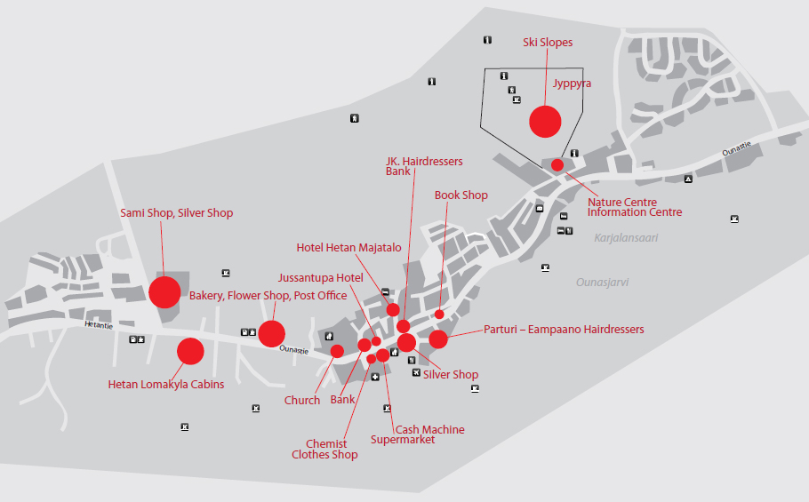
Hetta Downtown - Shops
A dedicated map presents Hetta's main shopping facilities in detail, and Google's own 'what to do in the area' view maps the accommodation options, the ski centre and the nature centre (the Skierri).
Good to know
- Distance from Hetta centre
- 4 km (west)
- Region
- Municipality of Enontekio, Finnish Lapland
- Nearby
- Enontekio airport, Lake Ounasjarvi, National Park
Ready when you are
Real wilderness, 200+ huskies, eighteen winters in.