
Hiking in Northern Scandinavia
An information resource on longer trail-hiking options across the far North, from Kilpisjärvi and the Käsivarsi Wilderness Area to the 800km Nordkalottleden Trail.
This section outlines the longer trail-hiking options in the North as an information resource.
Hiking with huskies on suitable trails gives plenty of direct time with your dog. Most routes are best in the snow-free months, though some are possible on snowshoes in winter. Dogs are attached to you by a skijoring line clipped to a waistbelt, so there is no fear of accidentally letting them go.
- Information resource on long-distance northern trails
- Kilpisjärvi: Saana (1029 m) and Halti (1324 m), Finland's highest fell
- Three Nations' Border Stone where Finland, Sweden & Norway meet
- Käsivarsi Wilderness Area: Finland's 2nd largest (2,206 sq.km)
- Nordkalottleden Trail: 800 km total, 70 km in Finland, 40 wilderness huts
- Best hiked July to mid-September
Hiking in Kilpisjärvi
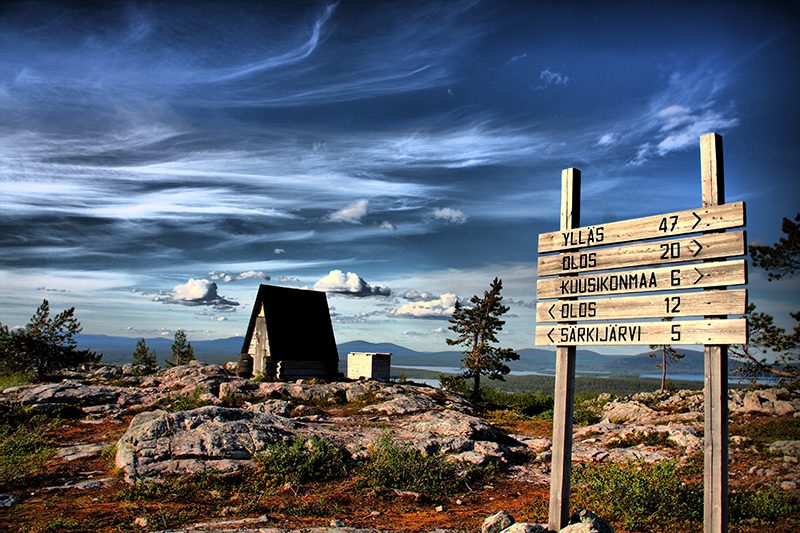
Kilpisjärvi, the main village in the arm of Finland, is a guide favourite in late spring and summer and the starting point for hikes into both the Käsivarsi Wilderness Area and the Malla Strict Nature Reserve.
Saana, said to be Finland's best known fell thanks to its shape, rises right beside the village. Halti, at 1324 metres Finland's highest fell, sits close to the Norwegian border, with marked hiking and skiing trails from Kilpisjärvi.
The Three Nations' Border Stone & Malla Strict Nature Reserve
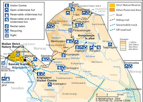
The Three Nations' Border Stone, where Finland, Sweden and Norway meet, stands on a man-made island in Lake Koltapahtajärvi in the Malla Strict Nature Reserve. The original rock cairn was erected in 1897, the current concrete marker in 1926.
Malla is Finland's oldest nature conservation area, established in 1916 and covering approximately 30 km2. Hike the Malla Trail from Kilpisjärvi to the border point (11 km) and back, or travel onboard the M/S Malla to Koltalahti and walk the final 3 km.
Käsivarsi Wilderness Area
Käsivarsi (2,206 sq.km, established 1991) is Finland's second largest wilderness area, in the NW corner of Enontekiö. It has no roads, though Raittijärvi Lapp village is inhabited for most of the year. Its NW fells are the only ones in Finland on the Scandinavian watershed, and apart from Saanatunturi Fell, every Finnish fell over 1000m lies here.
One marked trail crosses the area, the Kalottireitti - Nordkalottleden Trail, 60 km of which is within its bounds.
Nordic Nordkalottleden Trail (800 km)
The Nordic Nordkalottleden Trail runs 800 km, with a 70-km section through the Enontekiö / Käsivarsi region and the rest through Norway (380 km) and Sweden (350 km). The most popular Finnish stretch runs between Kilpisjärvi and Halti and back the way you came.
The trail is demanding and not for beginners. There are 40 wilderness huts along it, spaced 10 to 50 km apart. Hike the Finnish portion from the beginning of July to the middle of September, bring a tent, and never venture into the fell area alone.
King's Trail & Lyngen Alps
Further afield, the Kebnekaise area and the famous King's Trail in Northern Sweden are targets for many. We are also happy to offer mountain hikes near our base in the Lyngen Alps (Norway), though these routes are often glaciated and not suitable for the huskies.
Ready when you are
Real wilderness, 200+ huskies, eighteen winters in.